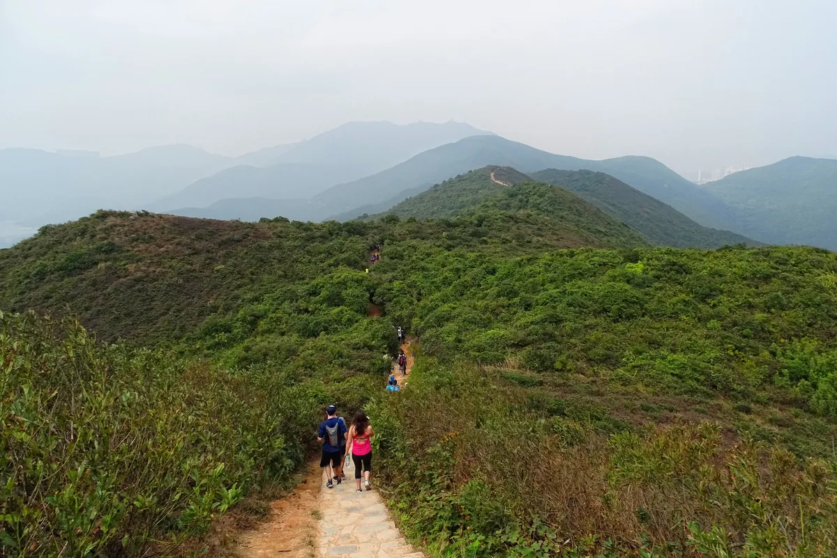
The first viewpoint can give you a clear point at which to reassess the climb, but it does not make the approach flat or easy. The initial ascent includes steps, and you still have to walk back down the way you came. If you want the ridge and the beach in one outing, plan for the full hike. Check trail notices and weather before leaving, and postpone either version if conditions do not suit the route.
Choose between the first viewpoint and the full walk to Big Wave Bay
The Hong Kong Tourism Board’s full Dragon’s Back route starts at To Tei Wan. It passes Shek O Peninsula Viewing Point, Shek O Peak, Dragon’s Back Viewing Point and Pottinger Gap before ending at Big Wave Bay. The board describes it as about 8 km, around four hours of hiking and moderate in difficulty. The four hours cover the trail itself. Add the hotel-to-trail journey, breaks and bus ride back when planning the day.
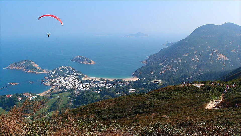
Two similar names can cause a planning mistake. Shek O Peninsula Viewing Point is the first viewpoint on the climb from To Tei Wan. Dragon’s Back Viewing Point comes later, after Shek O Peak, along the ridge. They are separate places. Reaching the first one does not mean you have completed the ridge section.
Turning back at the first viewpoint retraces the marked approach to To Tei Wan. The Tourism Board publishes no separate distance or time for this option. The initial climb and steps remain, so the full route’s 8 km and four-hour estimate does not describe the return walk.
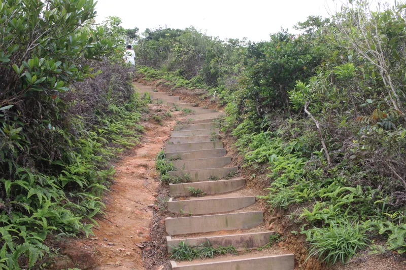
Start at To Tei Wan and finish at Big Wave Bay if you continue
The Tourism Board’s approach is to take Citybus route 9 from the bus terminus by Shau Kei Wan MTR Station, Exit A2, to To Tei Wan. Check the stop list and destination on the day of your visit so you board a service that calls at the trail start. The route number alone does not confirm that every service uses the same stop.
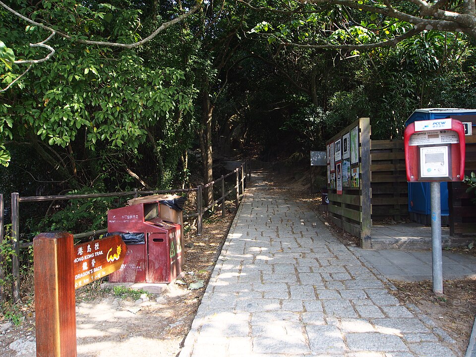
The full walk ends at Big Wave Bay, away from the To Tei Wan start. From the beach, check the current route 9 information for the return toward Shau Kei Wan, including the correct stop and direction. The short return described here brings you back toward To Tei Wan instead, so your bus plan depends on where you finish.
Shek O village and Big Wave Bay are different destinations. Keep the names separate when you read a map or save a bus stop. The Tourism Board describes the approach from Shau Kei Wan through its bus terminus to To Tei Wan; Citybus publishes current route and service information. Add time for the walk through the station, finding the terminus, waiting for the bus and any onward MTR connection. A trail walking estimate does not include those parts of the day.
For a shorter outing, reassess at the first viewpoint
If you want to see how the climb feels before committing to the ridge, use Shek O Peninsula Viewing Point as a decision point. From To Tei Wan, climb to the first viewpoint, take a proper pause and decide whether the weather, remaining daylight and your group’s pace support continuing. If they do not, return along the same marked approach to the start.
The shorter option follows the opening path back. Use the marked trail rather than treating an unverified road or bus stop as an exit. Turn back earlier if the footing, weather or your group’s pace feels unsuitable. Set a time to reassess before leaving the city and allow room for the return bus.
Take the full route only with the descent and return included
Beyond the first viewpoint, the full route continues over Shek O Peak at 284 m, along the ridge to Dragon’s Back Viewing Point and Pottinger Gap, then down to Big Wave Bay. The Hong Kong Tourism Board’s estimate of about 8 km and four hours covers the hike. Add travel to the trailhead, breaks, time to find the bus and the return journey before scheduling other plans.
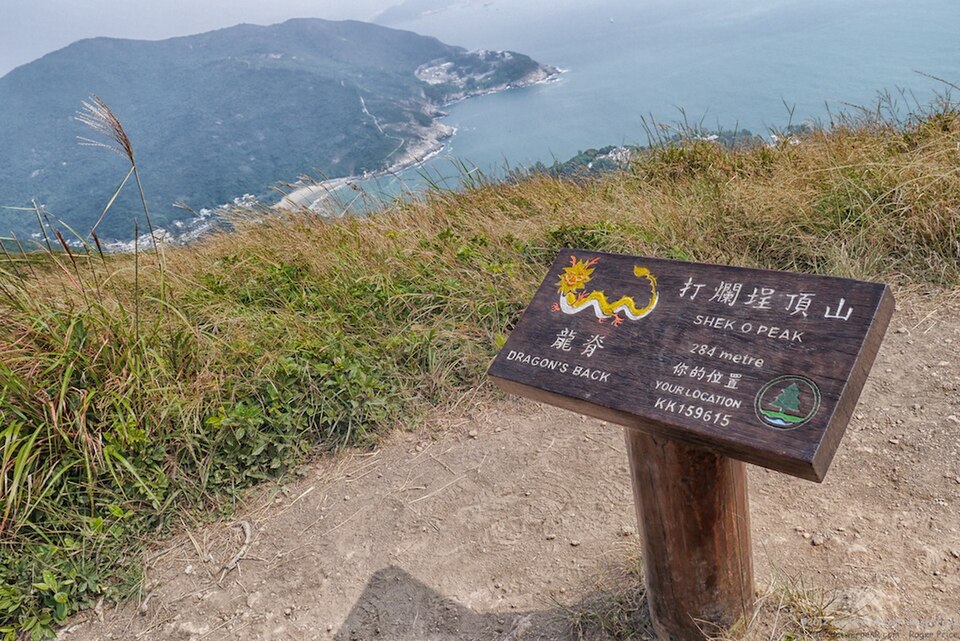
The early climb includes stairs. Pause to check the weather, pace and remaining daylight, then keep the descent to Big Wave Bay in the plan. The Agriculture, Fisheries and Conservation Department identifies Dragon’s Back as part of Stage 8 of the Hong Kong Trail, which continues to Big Wave Bay. Use the Tourism Board’s To Tei Wan approach as the visitor start, and follow signs and closure notices on site.
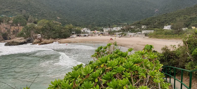
Big Wave Bay is at the end of the full route. You can add a beach stop after the descent, but that means allowing more time before the bus and evening plans. Reaching the beach is not a recommendation to swim, and this guide makes no claim about lifeguard cover or swimming conditions on a particular day.
Your finish point determines the bus you need
After the full route, you are at Big Wave Bay. Check Citybus’s current route 9 information, stop signs and direction for the service toward Shau Kei Wan. After the first-viewpoint return, use the To Tei Wan start stop instead. The route is linear, so the right bus depends on where you finish; timetables and last departures can change.
A rest at Big Wave Bay is optional. If you have an evening reservation or a connection to make, going straight to the bus after the descent leaves more room in the plan.
Do not delay the descent to watch sunset from the ridge. Sunset time, hiking pace, remaining daylight and bus service are separate constraints. Check the official information for your date, then set your hike around getting down with daylight to spare. A scenic view does not extend the bus schedule.
Check the trail forecast and closure notices before leaving
Conditions on the ridge can differ from what you see in the city. The Hong Kong Observatory provides a hiking trail weather service and notes that route forecasts can differ from its general forecast. Check the route forecast along with official weather warnings and trail notices before you travel to the start. An October date alone does not guarantee a cool, dry day.
The Leisure and Cultural Services Department advises checking the weather, wearing suitable footwear, carrying water and food, keeping a charged phone and finishing before daylight runs out. Avoid adverse weather and follow closure instructions. Carry what you need before leaving the city, and do not plan around finding services on the ridge.
The shorter return still includes the initial climb and descent. Rain, wind, poor footing or low visibility can affect either option, so a shorter walk is not automatically suitable in bad conditions. If the weather or trail notices look wrong, choose another day instead of improvising an exit or bypassing a closure.
Choose a hotel for the rest of your Hong Kong itinerary
You do not need to move hotels closer to the trail for this hike. EAST Hong Kong in Taikoo Shing is worth considering if your wider plans include eastern Hong Kong Island or you want to stay near the Island Line toward Shau Kei Wan. The Hari Hong Kong in Wan Chai may fit a trip centered on Wan Chai and Causeway Bay. Neither is at the trailhead, so include the MTR and bus legs in your morning plan.
If most of your sightseeing is in Central or Kowloon, an eastern base can add travel on other days. Compare the full itinerary, including where you will be in the evening and how you return after the hike. A hotel’s map location does not account for the walk to an MTR entrance, luggage or station transfers.
EAST Hong Kong, above Tai Koo MTR
EAST Hong Kong is at 29 Taikoo Shing Road. The hotel’s official directions say it is directly above Tai Koo MTR Station. From there, you can take the Island Line east to Shau Kei Wan, then continue by route 9 to To Tei Wan. Check the current bus stop and service on the day. The hotel is a city base, not accommodation beside the trail.
The location can suit a trip that already includes eastern Hong Kong Island and a return to the same hotel after the hike. Its trade-off is the longer journey west to Central and across the harbor to Kowloon for other sightseeing. Choose it for the whole itinerary rather than for the trail alone.

Before booking, check that the selected room’s stated occupancy matches everyone staying and review the bed setup separately. Confirm whether breakfast is included, the cancellation deadline, late check-in terms and luggage storage after checkout for that room and rate.
The Hari Hong Kong, for Wan Chai and Causeway Bay plans
The Hari Hong Kong is at 330 Lockhart Road. Its official directions give approximate distances of 500 m to Causeway Bay MTR Station and 550 m to Wan Chai MTR Station. Treat those as location estimates, not a guaranteed door-to-platform time. Your route can vary with the station entrance, street crossings, luggage and walking pace.
This hotel may suit a trip that combines Wan Chai or Causeway Bay with the hike. In the morning, you still need to walk to an MTR station and travel east to Shau Kei Wan before taking the bus to To Tei Wan. That approach is farther west than the one from Taikoo, so the hotel makes sense when its urban location also serves the rest of your stay.

Consider the walk between the hotel and the station, then compare that with your plans elsewhere in the city. On the booking page, check the occupancy and bed configuration of the exact room, breakfast, cancellation terms and whether late check-in fits your arrival. Ask the hotel or read the selected rate’s details for luggage storage after checkout.
Official information to revisit once your date is set
- Hong Kong Tourism Board: Dragon’s Back route and access
- Agriculture, Fisheries and Conservation Department: Shek O Country Park and Hong Kong Trail Stage 8
- Citybus route and current service information · Route reference for To Tei Wan and Big Wave Bay
- Leisure and Cultural Services Department hiking safety guidance · Hong Kong Observatory hiking trail weather service
- EAST Hong Kong location · The Hari Hong Kong location
Route and hotel-location details were checked against official information on 17 October 2026. Weather, trail access, bus operations and room terms can change. Recheck the official notices and the exact room rate for your visit. This is a route-planning guide based on published information, not a first-hand account of a hike.


